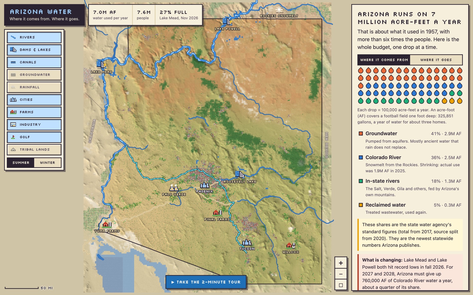
I wanted a better understanding of where Arizona’s water comes from and where it all goes, so I had Claude Fable 5.2 build me a SimCity-style map. It’s pretty fun!
A few things I learned:
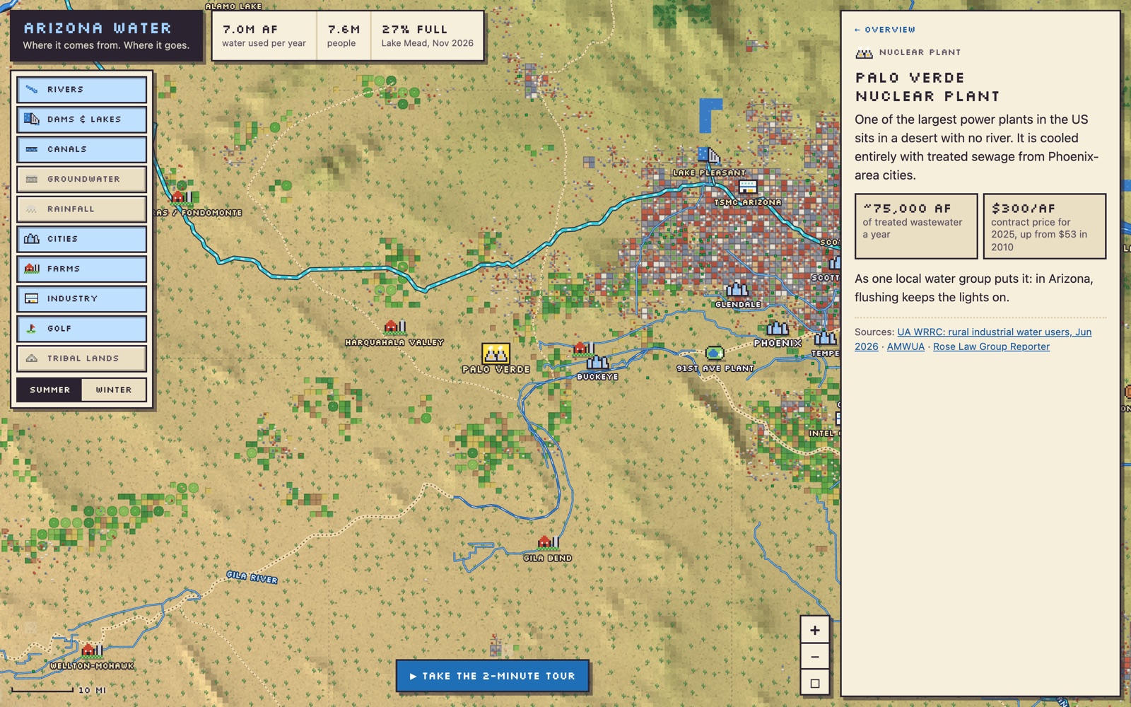
- About a quarter of the electricity generated in Arizona comes from the Palo Verde nuclear plant, a 3.9-gigawatt station in the desert west of Phoenix. It is cooled entirely with treated sewage from the Phoenix metro area.
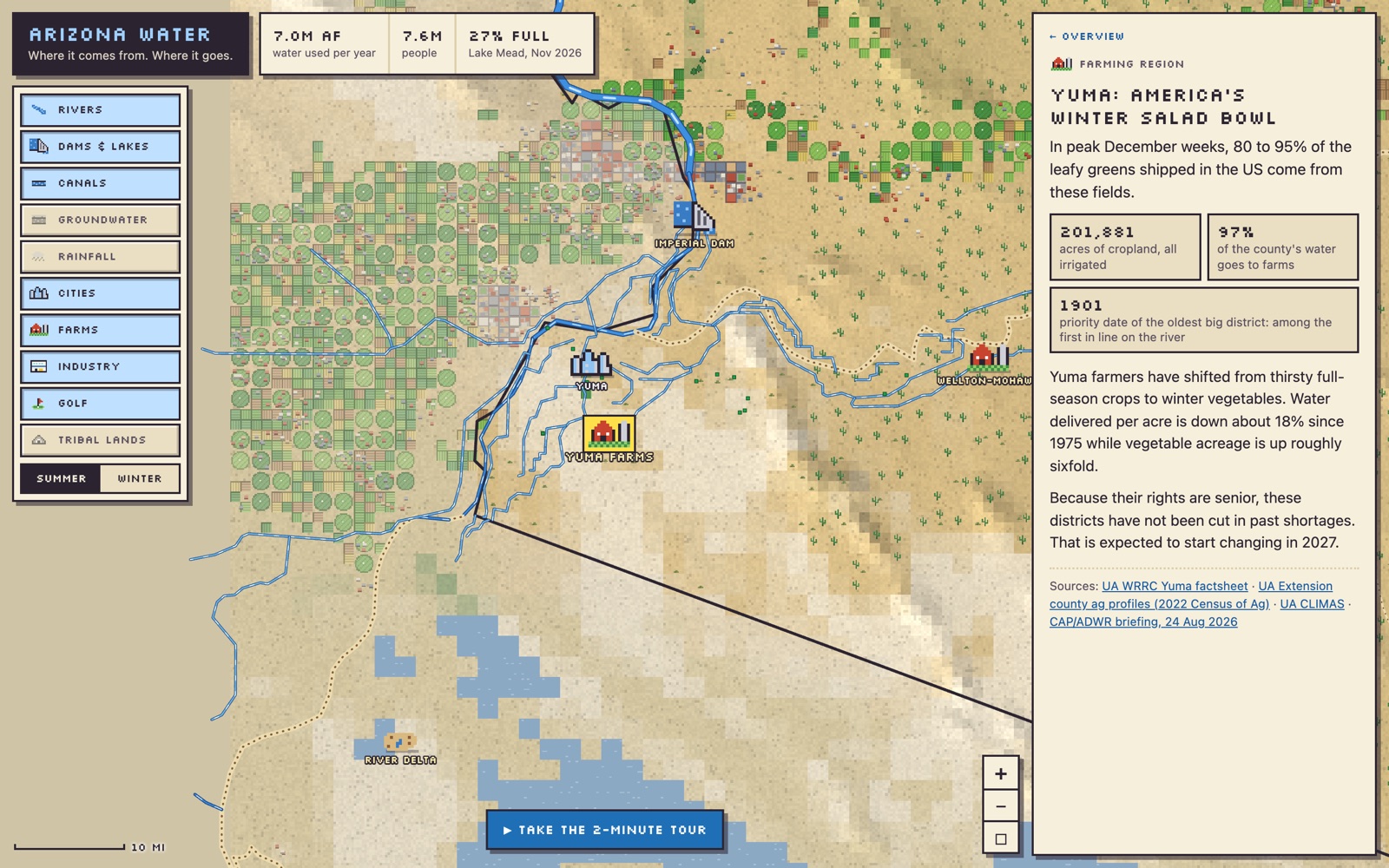
- Farmers around Yuma, in Arizona’s southwest corner, hold some of the most senior water rights on the Colorado River. They mostly grow winter vegetables, and in peak December weeks they ship 80–95% of the leafy greens in the US.
- I’d seen news coverage of a Saudi-owned company growing alfalfa in Arizona to ship home for dairy cows. The state ended the company’s leases of state land in 2024, though it still owns about 10,000 acres nearby and the Attorney General is suing over its pumping.
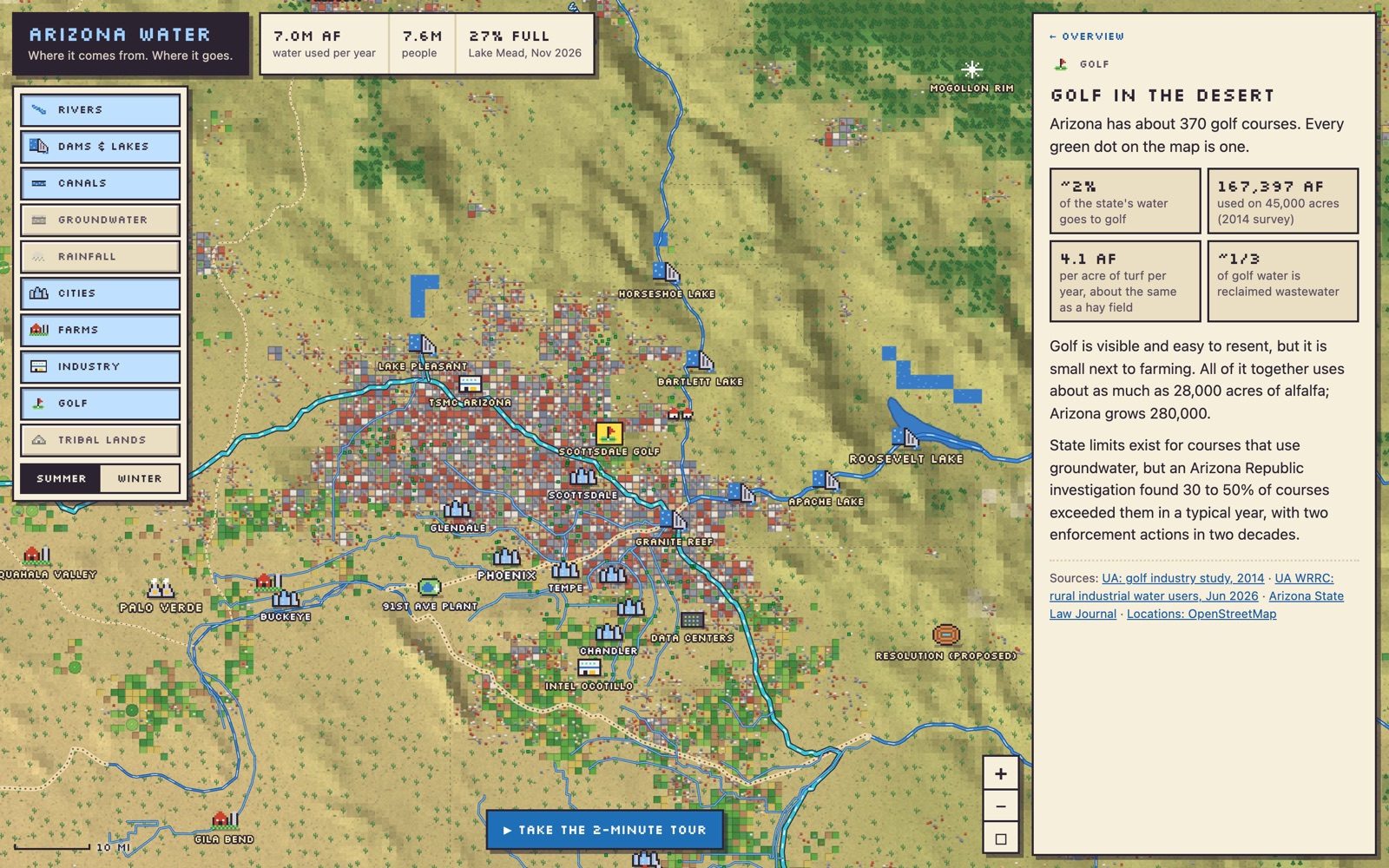
- About 2% of the state’s water goes to golf courses, and roughly a third of that is reclaimed wastewater.
Check it out for yourself and let me know what you think!


Leave a Reply